[Warlands]: Preliminary Geographical Map

A forum for discussing the many DCC modules published under third edition rules, EXCEPT for Castle Whiterock, which has its own forum.

Moderators: DJ LaBoss, finarvyn, Harley Stroh

Post Reply
James Mishler
Wild-Eyed Zealot
Posts: 74
Joined: Sat Oct 21, 2006 7:30 am
Location: Appleton, Wisconsin
Contact:

[Warlands]: Preliminary Geographical Map

Post by James Mishler »

Here's a preliminary version of the map I will be using for my Warlands campaign. It only includes geography; no settlements, ruins, etc. are on the map as yet.

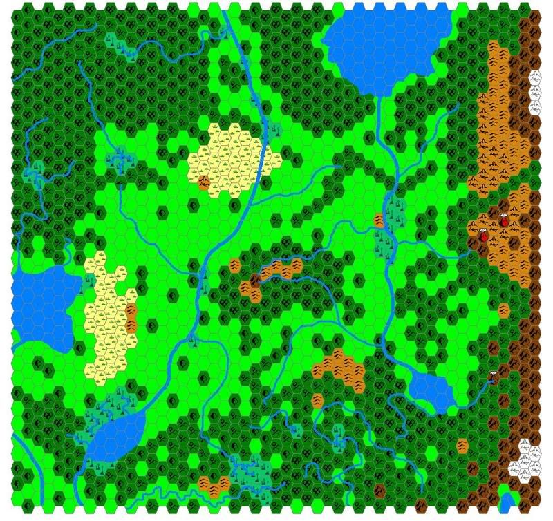
This map uses the early hexes as developed by Andrew Theisen; I unfortunately do not have the ability to use the hexes developed by Thorfinn Tait. Maybe when I get a computer upgrade (shortly after I win the lottery).

The hexes are 24 miles across. The hexes are a bit wonky east to west, and the entire map seems scrunched. If you want to see what the map should look like, drop this image into a Word page set to landscape, and stretch the image to fit the whole page.

While Photobucket shrank the map some, it still looks pretty bad with the base JPG; I dunno why, but Paint is really screwing with me lately when I convert from BMP to JPG... :(

Image
James Mishler
Personal Gameblog: http://adventuresingaming2.blogspot.com
Cardinal
Wild-Eyed Zealot
Posts: 73
Joined: Tue Dec 12, 2006 5:54 am

Post by Cardinal »

WOW!
It's distorted, sure, but with "Warlands" you mean the area of Koranth, Leherti, the Scourgelands and the Corsan Forest - correct?


Could you send me a copy of the original? BMP would be ok!
And do you have a version with cities included?

...man, this is awesome - especially since the focus of my campaign is slowly shifting to this area, and since two new PCs are coming from there...
James Mishler
Wild-Eyed Zealot
Posts: 74
Joined: Sat Oct 21, 2006 7:30 am
Location: Appleton, Wisconsin
Contact:

Post by James Mishler »

Cardinal,

Unfortunately, no, by Warlands I mean the former Kingdom of Valsund (a.k.a. the Warlands), the Kingdom of Morrain, the northeastern segment of Luithea, the western extent of the Holdfast of the Steel Overlord, and the northern section of the Wilds and the Halls of the Mountain King.

Also unfortunately, my e-mail system has an attachment limit of two megs, so the only way I could send out the original BMP would be thbrough Yahoo Chat or something like that...
James Mishler
Personal Gameblog: http://adventuresingaming2.blogspot.com
Harley Stroh
Cold-Hearted Immortal
Posts: 1805
Joined: Wed Sep 15, 2004 4:02 am
Location: On the run.
Contact:

Post by Harley Stroh »

James,

This _rules_. Wow. Absolutely brilliant.

Can't wait to see you at GenCon and throw down some dice.

I'll try emailing you again w/ my home address. If you toss all the bmps on a disk, I can find the space to host them.

//H
The lucky guy who got to write some Dungeon Crawl Classics.

DCC Resource thread: character sheets, judge tools, and the world's fastest 0-level party creator.
Cardinal
Wild-Eyed Zealot
Posts: 73
Joined: Tue Dec 12, 2006 5:54 am

Post by Cardinal »

oops, my bad...

...but *please* give Harley a copy of all those wonderful maps! I can hardly wait for them to be hosted here...
User avatar
Warduke
Mighty-Thewed Reaver
Posts: 299
Joined: Mon Mar 20, 2006 10:35 am
Location: Hidden Base in the NJ Wilderness

Post by Warduke »

maybe we could bribe mishler to do details of the scourge maps ...... :twisted: :twisted: :twisted: :twisted: :twisted: :twisted:
Member of Fathead's Favorite Posters Team
Nahat Anoj
Wild-Eyed Zealot
Posts: 74
Joined: Mon Mar 20, 2006 2:11 pm

Post by Nahat Anoj »

I like hex maps. :)
Cardinal wrote:It's distorted, sure, but with "Warlands" you mean the area of Koranth, Leherti, the Scourgelands and the Corsan Forest - correct?
On James's hex map above, there is a mountain range on the eastern edge, the Ul Dominors. The area you describe is on the other side of the Ul Dominors, to the east.
James Mishler
Wild-Eyed Zealot
Posts: 74
Joined: Sat Oct 21, 2006 7:30 am
Location: Appleton, Wisconsin
Contact:

Post by James Mishler »

Cardinal,

No promises, but I might get around to making that map you want...

Define which area you want the map centered on. A map like I've done here covers an area 5 1/2 inches (~800 miles) north to south by 7 1/4 inches (~1,000 miles) east to west on the Known Realms map. So the whole territory you describe can't be fit on one map. But name the core, and I'll see what I can do...
James Mishler
Personal Gameblog: http://adventuresingaming2.blogspot.com
Cardinal
Wild-Eyed Zealot
Posts: 73
Joined: Tue Dec 12, 2006 5:54 am

Post by Cardinal »

ooooohhh! It's like Xmas :D

my favorite core center of such a map? The Grand Duchy of Leherti (i.e. the occupied part)!
Post Reply

Return to “DCC Modules - 3E”